The World-renowned Tongariro Alpine Crossing is heralded as one of the top ten single day treks in the World. The 19.4 km trail spans the length of Mount Tongariro from alpine meadows to a mountain summit with stunning volcanic features along the way. It’s a landscape of craters, scattered pumice, active volcanoes, mountain springs, old lava flows, emerald lakes, piles of scoria and statue-like mounds of volcanic desert. On a clear day you can see Mt Taranaki, Mt Ngauruhoe, the Kaimanawa Ranges, Lake Taupo and beyond.
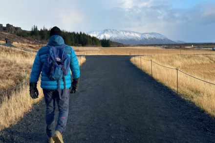
The Tongariro Alpine Crossing starts in the Mangatepopo Valley and finishes at Ketatahi Road. We were located a short bus ride away from the start of the trail thanks to a friend whose parents kindly let us borrow their holiday home. We were dropped off at the Mangatepopo car park early morning. It was a gloriously sunny day and we found ourselves de-layering fairly swiftly en route to Soda Springs. The track was pretty flat for the most part and it was board walked in the damper areas with poles marking the route.
The journey from Soda Springs to the South Crater was a challenge and certainly the most difficult. The aptly named Devil’s Staircase is steep and you’re climbing to 1,600 metres above sea level. You have to take your time and watch your footing as you’re trekking over ancient and modern lava flows as well as other volcanic deposits. The views down the valley when you reach the top are incredible though which more than makes up for the journey to get there. After a short refuel, we enjoyed the open expanse of the south crater before a steady climb up an exposed ridge towards the red crater. You can summit Tongariro from here although we decided against it as the weather wasn’t on our side. Once you’ve reached the red crater, there are spectacular views out over the Oturere Valley, Rangipo Desert, Kaimanawa Ranges and down towards the Emerald Lakes.
There is loose scoria underfoot as you descend from the red crater towards the blue lakes so you need to be careful. I rather enjoyed this as it was much easier on the legs although I nearly fell over a few times. On one side is an old lava flow from the red crater and on the other the stunning emerald lakes. Their turquoise colour is caused by minerals leaking from the surrounding rock with the steam vents causing a sulphurous smell. The ground is warm in parts, quite disconcerting given you’re a stones throw away from the top of a volcano! The walk from the Emerald Lakes to the edge of the North crater was easy. There is an abrupt change after that through a narrow saddle to the northern slopes. The landscape changed from gravel fields to lush slopes of red tussock which was a welcome change. The ground was quite boggy down to the Ketetahi Hut.
The track crosses a stream around ten minutes after leaving the Ketatahi hut. The rocks are stained due to the minerals in the water, algae and hot water. The route took us down open tussock land before dropping steeply in the forest towards the Mangatetipua stream. You know you’re near the end when you can hear the waterfall. Reaching the Ketetahi car park was a welcome relief particularly as we were out of water at this point!
It takes 7-9 hours to complete the Tongariro Alpine Crossing although somehow we managed 19.4kms in around six hours. I’m not sure how given we’d been at a friend’s wedding just 48 hours earlier! Although difficult at times, the views are awe-inspiring and totally make it worthwhile. After quenching our thirst, we rewarded ourselves with an ice-cold beer at the end!


I love what you’ve done here with all your travel posts. You have been to some amazing places. I have a handful of travel posts in draft form on my blog now but your photos are beautiful x
Thank you so much Karen, really kind of you. The Tongariro Crossing was incredible. If I did it again, I’d perhaps time it so it wasn’t after a friends wedding!
It’s absolutely gorgeous. I knew NZ has some stunning places but hadn’t heard of this before. I want to add this to the list of places I’d like to go!